Project

FRP Highway 101 Gold Project

Underexplored Gold Asset

27
contiguous claims
471
hectares
100%
option
  • On the North Branch of the Porcupine-Destor Deformation Zone (PDDZ)
  • Adjoins Agnico Eagle's past-producing Holt & Holloway Mines
  • Only 4 historic drill holes ever completed — none through the central target
  • 2022–2025 high-resolution Mag + VLF-EM surveys completed
  • Immediate drill-ready targets under thin glacial cover
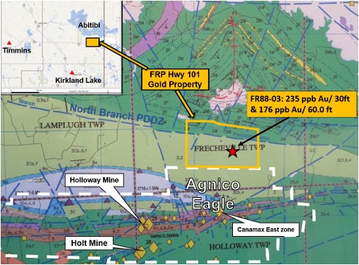
FRP Highway 101 Project Location Map

Geological Setting

The property lies directly on the projected North Branch of the Porcupine-Destor Deformation Zone — the same major gold-controlling structure that hosts multiple multi-million-ounce deposits in the Abitibi.

Regional mapping (Ontario Geological Survey) confirms the PDDZ runs through the centre of the claims. Outcrops in the north and south portions of the property; the central target zone is covered by glacial sand and clay — creating a classic "blind" discovery opportunity.

Alteration (sericite, silica, carbonate, pyrite) matches the gold systems at the adjacent Holt and Holloway mines.

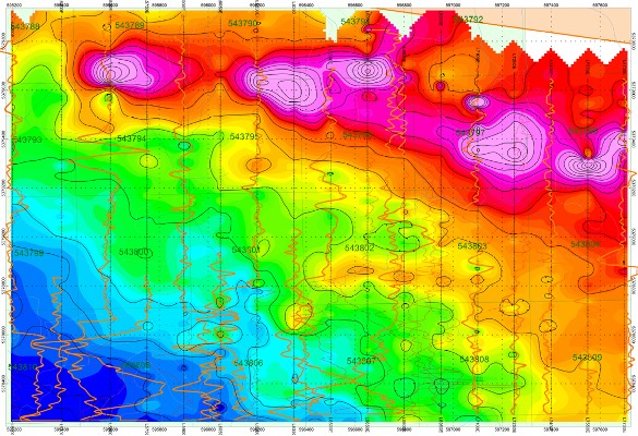
Geological survey 1
Magnetometer Survey – Combined total field magnetic contoured plan superimposed on VLF in-phase / out-phase profiles.
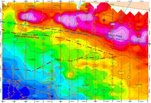
Geological survey 2
Mag map with VLF readings in red: projected OGS AEM conductors (red dash), cross faults (fine blue) & N Branch LLCB (heavy blue) dashes.
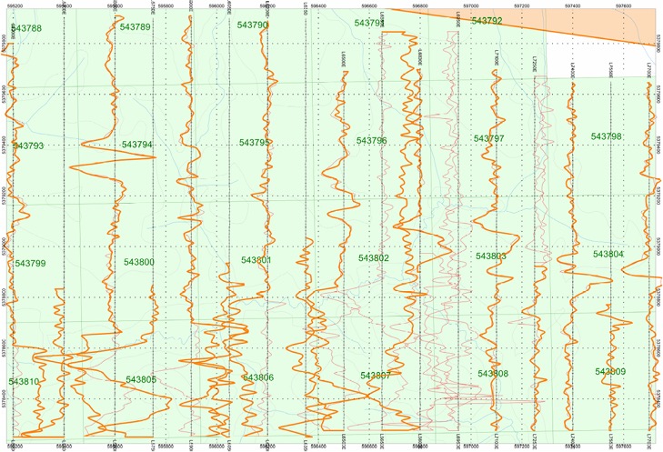
Geological survey 3
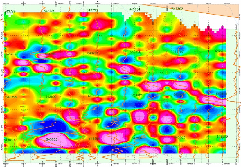
VLF-EM data: Note the major crossovers - major structures or interflow gfc seds, and the multitude of minor crossovers
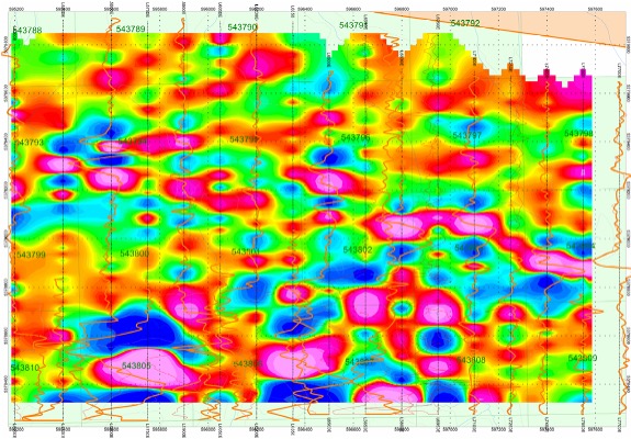
Geological survey 4
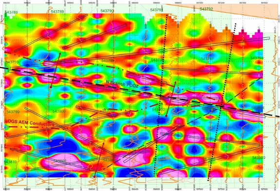
Colour Contoured VLF-EM plot displays a multitude of anomalies at various attitudes.
Geological survey 5
Colour Contoured VLF-EM showing interpreted conductors with the projected OGS AEM conductors and N Branch LLCB; proposed ddhs (red).

Historic Work & Geophysics

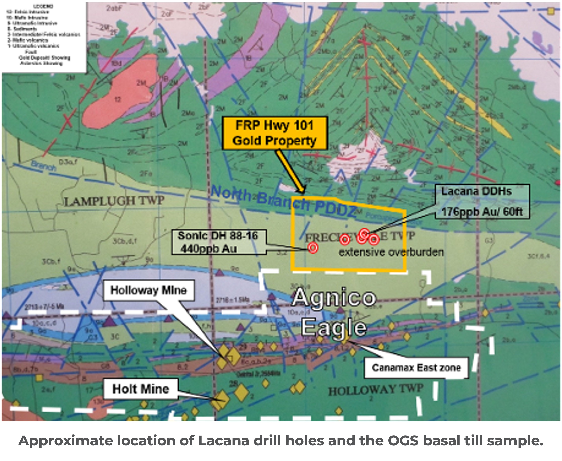
Highly underexplored: Only four drill holes were completed on the property (Lacana Mining, 1988). None tested the central portion of the North Branch PDDZ

Significant gold anomalies were returned, including:

  • Up to 300 ppb Au over significant widths
  • FR88-03: 235 ppb Au over 9.1 m (30 ft)
  • FR88-03: 176 ppb Au over 18.3 m (60 ft)
  • OGS basal till sample returned 440 ppb Au south of the projected PDDZ.
  • 2022–2025 high-resolution Mag + VLF-EM surveys (150 m grid) have now defined strong conductive horizons and structural features aligned with the PDDZ.
Historic drilling and geophysics

Project Potential & Discovery Upside

The project remains highly underexplored, with only four holes drilled by Lacana Mining in 1988 — none of them testing the central PDDZ.

  • Central portion of the North Branch PDDZ remains completely untested by drilling
  • Glacial sand and clay cover the target zone. The 2022–2025 Mag + VLF-EM surveys have identified multiple strong conductive anomalies and major structural crossovers directly on the deformation zone.
  • Proposed diamond drill holes now target the heart of the structure under thin glacial cover.
  • The alteration and geological setting are consistent with the gold systems in the surrounding area.
  • Visual: VLF-EM contoured map with projected PDDZ, interpreted conductors, and proposed drill holes (red).
Low-cost, fully funded Phase 1 drill program — ready to unlock the next Abitibi discovery in 2026.
Project Potential and Drill Targets

Join the Journey

Sign up for regular updates on our progress.